Physical Address
Bankura, West Bengal 722142
Physical Address
Bankura, West Bengal 722142


Driving the Dawki to Tawang distance is one of the best road trips in Northeast India. You travel from the clear waters of the Umngot River in Meghalaya all the way to the snowy mountains of Arunachal Pradesh.
On a map, the route looks like 585 km. But mountain roads and turns make the real drive over 620 km through three states: Meghalaya, Assam, and Arunachal Pradesh. Because the roads are steep and winding, trying to do this trip in one day is unsafe and very tiring.
In this guide, you will get real driving times, new Sela Tunnel updates, and a simple 2-day plan for a safe trip.
Before we dive into the full guide, here is how the Dawki start point compares to other popular routes into Tawang. If you are exploring other mountain routes across the Eastern Himalayas, check out our detailed Gangtok to Darjeeling distance guide for similar terrain advice.
| Route | Estimated Distance | Avg. Travel Time |
| Dawki → Tawang | 620+ km | 15 – 18 hours (2 Days) |
| Shillong → Tawang | 550+ km | 13 – 15 hours (2 Days) |
| Guwahati → Tawang | 450+ km | 12 – 14 hours (1.5 Days) |
Tawang is a beautiful but high-altitude town. At 10,000 feet, the air is thin, so you might feel tired just walking across the street. Much like exploring other freezing high-altitude viewpoints like Lungthung, preparing for thin air and sudden weather drops is essential. The famous Tawang Monastery is huge and great to explore. The town itself has narrow streets, friendly locals in heavy wool clothes, and amazing views.
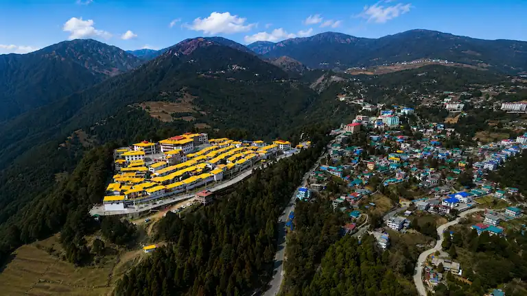
You might get a mild altitude headache, and the drive up is tough, but seeing the giant Buddha statue through the mist makes it all worth it. It takes real effort to get there, but it is a magical place.
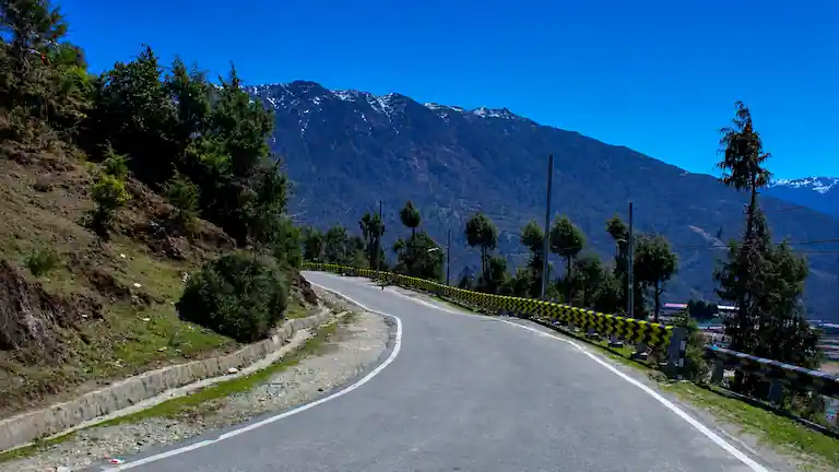
Driving 600+ km is easy on a normal highway, but mountain driving is a different story. Much like driving the Chandigarh to Manali mountain route, steep elevation gains drastically reduce your average speed. Once you leave the flat lands of Assam, your speed drops. Between heavy fog, slow army trucks, and border checks, driving straight through is just not possible.
Here is a clear look at the Dawki to Tawang distance and what you can expect in terms of cost, time, and comfort.
| Mode of Transport | Avg. Cost (INR) | Travel Time | Comfort Level | Best For |
| Private SUV (Innova) | ₹15,000 – ₹25,000 | 2 Days | High | Families, Photographers |
| Shared Taxi (Sumo) | ₹1,200 – ₹1,500/seat | 2 Days | Low (Bumpy) | Budget Backpackers |
| State Bus | ₹1,300 – ₹1,500 | 19+ Hours | Very Low | Extreme budget travelers |
| Helicopter (From GAU) | ₹4,000 – ₹4,500 | 1.5 Hours | Very High | Time-crunched travelers |
Maps will only show you the distance, but not the physical toll this drive takes. Here is the reality of the road based on my own GPS logs and tracking data.
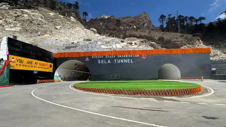
The main reason this drive is so hard is the massive change in height. You start the trip at Dawki, which is only about 50 meters above sea level. By the time you reach the Sela Tunnel area, you climb to an extreme 4,170 meters (around 13,700 feet). This drastic change is exactly why travelers experience serious altitude sickness, not just normal travel fatigue. The air gets very thin, very quickly.
Do not trust map apps that tell you to drive 60 km/h. Here is how fast you will actually move during the 620+ km trip based on real driving logs:
To stay safe and avoid driving on dark, dangerous mountain roads, you must stop halfway.
You need to leave Dawki early, by 5:30 AM without any excuses. This helps you beat the slow coal trucks on the climb to Shillong. Do not expect the Guwahati bypass to be fast; it is often full of traffic and dust.
It is a smart move to skip Tezpur. It adds extra city traffic you do not need. Drive straight to Bhalukpong. It sits right on the border. You can sleep there, show your Inner Line Permit (ILP) at the gate the next morning, and start driving before the crowds. The hotels are basic, but you will be glad you are already at the Arunachal border when you wake up.
This is the most scenic part of the whole trip. You pass through Bomdila and Dirang before reaching the high mountains.
There are no direct flights or trains near Tawang. Because the Dawki to Tawang distance is so huge, almost everyone goes to Guwahati first and starts the mountain climb from there.
If you have the money, hiring a Scorpio or Innova is the best way. You can tell the driver to pull over for photos or if you feel sick from the turns. Make sure your driver has actually done the Tawang route before. You need a mountain driver, not a city driver. It costs more, but having control over your trip is the best way to travel comfortably.
A shared Sumo is fast, but it is a gamble. The back seats are very bumpy, and you will bounce around on the rough roads. If you have extra cash, pay for two seats just to get some breathing room. Otherwise, show up at the taxi stand by 5:00 AM and fight for the front seat.
The bus is cheap, but it is a brutal 19-hour trip. If you try to do it all in one shot, you will arrive in Tawang feeling completely dead. The mountain turns will throw you around for hours. The smartest choice is to get off at Bomdila, rent a cheap bed for the night, and finish the trip the next morning.
If you ride a bike to Tawang, be ready for a messy ride. Between Bhalukpong and Dirang, the roads are dusty with massive trucks. The wind at 13,000 feet near Sela is freezing. Make sure your bike has great tires because the mud near the road work acts like glue. It is a killer ride, but plan to sleep for a full day once you arrive.
If you can get a seat on the Tawang chopper, take it. The views are incredible, and it beats sitting in a car for two days. But tickets are very hard to get. The flights often get canceled at the last minute if there is mist at the pass. Always have a backup taxi ready in Guwahati.
Do not take the train to Rangapara North. It looks like it saves time on a map, but it is a trap. Trains are often late, meaning you miss the morning taxis. Get off at Guwahati instead. Walk out the back toward Paltan Bazaar where all the shared cabs are. At least you will not be stranded at a tiny station.
Your ILP is just a gate pass for Arunachal Pradesh. It will not get you to the China border. Even after driving the huge Dawki to Tawang distance, you still need a special military permit from the DC Office in Tawang to visit Bum La Pass or Madhuri Lake.
You need two passport photos and a hard copy of your Aadhaar card. Bring at least 6 photocopies from home to save money. Also, outside vehicles are banned on the Bum La road. You have to hire a local Tawang taxi, which costs ₹5,500–₹6,000. Give your papers to your hotel manager when you arrive. They can get the permit sorted while you go visit the monastery.
Choosing your dates is super important. Because you are traveling over 600 km, you are crossing two different worlds. You start in the hot hills of Meghalaya and end up freezing in the Himalayas. If you are planning an extended Northeast circuit beyond Meghalaya and Arunachal Pradesh, combining this drive with offbeat destinations in Sikkim like Lingtam gives you a complete view of the Eastern Himalayan belt.
If you are a first-timer or traveling with family, this is the best time. The weather stops being freezing cold, and the beautiful Rhododendron flowers bloom everywhere in April and May.
If you want clear views, October is the sweet spot. The sky is perfectly clear, and you can see the mountain peaks easily. The roads are also much drier.
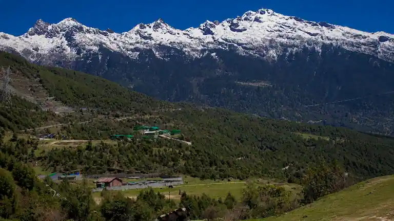
But the temperature drop is extreme. You will sweat in the sun at 2 PM, but by 4:30 PM, you will be freezing. Bring heavy thermals. Also, try to shower by 7 AM before the hot water runs out in the local homestays.
If you go between December and February, be ready to freeze. Tawang looks amazing under the snow, and the Torgya Festival in January is incredible. But night temperatures drop to -10°C.
This trip is a massive test of endurance. If you do not manage your fuel, food, and sleep, things go bad fast. Here is how to handle the real ground conditions.
Fill up completely in Guwahati or Tezpur. Fuel is cheaper there. Once you pass Bhalukpong, gas stations can run dry if a landslide blocks the supply trucks.
Do not wait until your tank is empty. If you pass a gas pump in Bomdila or Dirang, top up even if you have half a tank. If you are on a bike, strap a 5L fuel can to the back.
Food changes fast in the mountains. You leave behind the rice and curries of Assam and start living on noodles (Thukpa) and momos. The army canteens are life-savers because they serve piping hot food when it is freezing out.
In Tawang, try the local Monpa food. Order “Zan,” a heavy millet porridge that keeps you full for hours. Drink butter tea; it is salty and fatty, but it stops your lips from cracking in the cold wind. Pack a bag of snacks like chocolates, nuts, and plenty of water. Staying hydrated stops altitude headaches.
Stop for the night in Dirang, not Bomdila. Bomdila is higher up and freezing. Sleeping lower down in Dirang helps you wake up without a massive headache. If you enjoy serene, quiet mountain towns similar to the offbeat hill stations near Mirik, Dirang offers a very peaceful environment. If you want comfort, book a room at Dirang Boutique Cottages or Pemaling Lords Inn.
In Tawang, try to stay near the Old Market so you do not have to hike up steep hills just to get dinner. Make sure the hotel has a proper room heater (a Bukhari), not just an electric one that dies when the power cuts. Hotel Tawang Holiday and Hotel Dekhang are great, highly-rated options right near the Old Market.
The Dawki to Tawang distance is a really long slog. It is over 600 km, and between the army convoys and the fog, you will move slow. The Sela Tunnel is a total lifesaver now, but mountain weather still does whatever it wants.
Do not try to be a hero and drive it in one day. Split the drive into two days, keep your ILP copies in your pocket, and accept that you will get stuck behind a truck. Take it slow, stay safe, and enjoy the wild views. For more expert advice on navigating tricky routes, explore our other travel guides and road trip tips.
Indian citizens need an ILP to enter Arunachal Pradesh. You can apply online safely at the official Arunachal Pradesh government eILP portal. Have a scan of your Aadhaar card and a passport photo ready. It costs about ₹300. Do it early and print at least three paper copies, because check posts rarely accept a PDF on your phone.
No way. The distance is massive. You are looking at nearly 20 hours of driving if you hit bad traffic. By the time you reach the high altitudes, you will be dizzy and exhausted. Stop in Dirang to rest.
The Sela Tunnel is a huge upgrade. It provides a safe, all-weather road that skips the highest, icy part of the Sela Pass. It saves time and keeps Tawang easy to reach all year long.
Author Bio: Written by Mampi Pal, a travel expert who has driven the Meghalaya-Arunachal circuit multiple times to verify road conditions and routes.